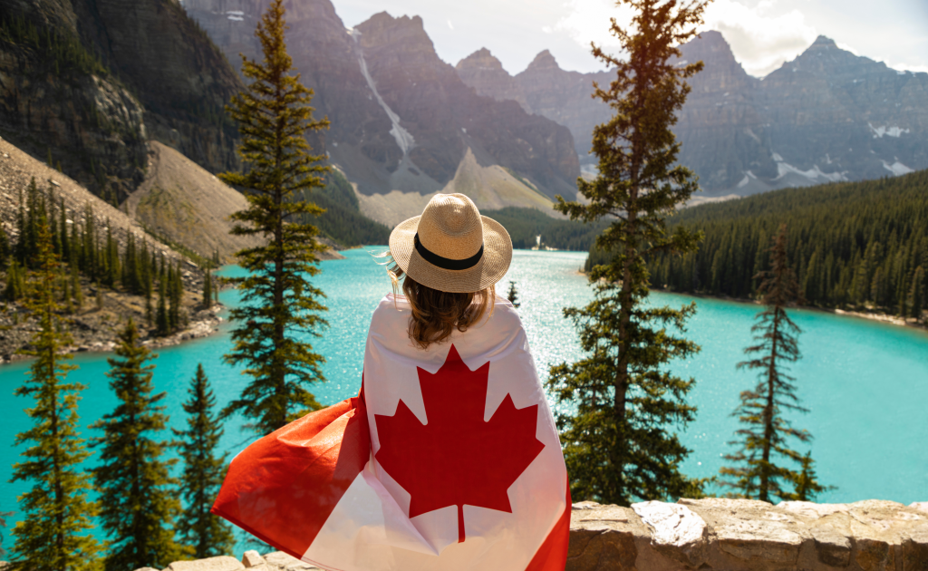
Canada is a gorgeous country for hiking with many, many hiking trails for locals and tourists to try. We have reviewed our 20 favorite hiking trails in Canada below. Before you start your Canadian hike, make sure to check out the best time to visit Canada. And if you are in the USA, you can combine your Canadian hike with a surprise US road trip, to go along with your hiking vacation!
Our 20 Favorite Hiking Trails in Canada, Updated for 2025:
Below is Competitours’ list of the top 20 hiking trails in Canada, including information for distances, elevation gain, difficulty, and navigational details:
1. West Coast Trail (British Columbia)
- Location: Pacific Rim National Park Reserve, Vancouver Island
- Distance: 75 km (47 miles) point-to-point
- Elevation Gain: 1,800 meters (5,900 feet) cumulative
- Difficulty: Strenuous
- Trailhead: Pachena Bay (north) or Gordon River (south)
Originally a lifesaving route for shipwreck survivors, the West Coast Trail is a challenging multi-day trek through dense rainforests, beaches, and rugged coastal cliffs. Hikers navigate ladders, cable cars, and river crossings while spotting sea lions, whales, and shipwreck remains. Permits are required, and the trail is open from May to September.
2. Skyline Trail (Alberta)
- Location: Jasper National Park
- Distance: 44 km (27 miles) point-to-point
- Elevation Gain: 1,200 meters (3,940 feet)
- Difficulty: Moderate to Strenuous
- Trailhead: Maligne Lake (main access)
One of Jasper’s most iconic hikes, the Skyline Trail stays above the treeline for over 25 km (16 miles), offering panoramic views of the Rocky Mountains. Highlights include The Notch (highest point at 2,511 meters / 8,238 feet) and Big Shovel Pass. The trail requires shuttle logistics between trailheads and permits for backcountry camping.
3. Berg Lake Trail (British Columbia)
- Location: Mount Robson Provincial Park
- Distance: 41.5 km (25.8 miles) round trip
- Elevation Gain: 800 meters (2,625 feet)
- Difficulty: Moderate to Strenuous
- Trailhead: Berg Lake Trailhead, off Highway 16
This glacier-fed alpine hike leads to Berg Lake, where Mount Robson (3,954 meters / 12,972 feet) towers over floating icebergs. Along the way, hikers pass Kinney Lake, Emperor Falls, and Marmot Campground. Backcountry permits are required, and spots fill up quickly. The best time to hike is July to early September.
4. The Rockwall Trail (British Columbia)
- Location: Kootenay National Park
- Distance: 55 km (34 miles) point-to-point
- Elevation Gain: 2,600 meters (8,530 feet)
- Difficulty: Strenuous
- Trailhead: Paint Pots or Floe Lake
This backcountry trail features a towering limestone wall, turquoise lakes, and stunning waterfalls. Major highlights include Floe Lake, Helmet Falls (352 feet), and Numa Pass (highest point at 2,350 meters / 7,710 feet). The trek takes 3-5 days, and permits are required for backcountry camping.
5. Gros Morne Mountain (Newfoundland & Labrador)
- Location: Gros Morne National Park
- Distance: 16 km (10 miles) round trip
- Elevation Gain: 800 meters (2,625 feet)
- Difficulty: Strenuous
- Trailhead: East of Rocky Harbour, near Route 430
Beneath Your Feet – Gros Morne National Park, UNESCO World Heritage Site
The highest point in Newfoundland (806 meters / 2,644 feet), this rocky summit trail offers views of fjords, tundra, and glacial valleys. The steep scree climb is challenging, but the panoramic views make it worthwhile. The trail is only open from June to October to protect the fragile ecosystem.
6. Tonquin Valley Trail (Alberta)
- Location: Jasper National Park
- Distance: 44 km (27 miles) point-to-point
- Elevation Gain: 750 meters (2,460 feet)
- Difficulty: Moderate
- Trailhead: Astoria River or Portal Creek
A serene alpine valley surrounded by the jagged Ramparts Range, Tonquin Valley is famous for its mirror-like lakes and diverse wildlife, including grizzly bears and caribou. The hike is best in late summer (July-September) when muddy sections dry up. Backcountry camping permits are required.
7. Grizzly Lake Trail (Yukon)
- Location: Tombstone Territorial Park
- Distance: 22 km (13.7 miles) round trip
- Elevation Gain: 1,100 meters (3,610 feet)
- Difficulty: Strenuous
- Trailhead: Dempster Highway, Km 58
This remote Arctic wilderness hike leads to Grizzly Lake, surrounded by the rugged peaks of the Tombstone Mountains. The trail is steep, exposed, and often muddy, requiring strong navigation skills. Permits are mandatory, and bear safety precautions are crucial.
8. La Cloche Silhouette Trail (Ontario)
- Location: Killarney Provincial Park
- Distance: 78 km (48 miles) loop
- Elevation Gain: 2,100 meters (6,890 feet)
- Difficulty: Strenuous
- Trailhead: George Lake Campground
A hidden gem in Ontario, this multi-day loop offers quartzite ridges, pristine lakes, and sweeping views of Georgian Bay. Silver Peak (539 meters / 1,770 feet) is a must-climb for panoramic scenery. Backcountry permits are required, and the best season is June-September.
9. Fundy Footpath (New Brunswick)
- Location: Fundy National Park
- Distance: 49 km (30 miles) point-to-point
- Elevation Gain: 3,000 meters (9,840 feet) cumulative
- Difficulty: Strenuous
- Trailhead: Big Salmon River or Point Wolfe
Following the Bay of Fundy, this rugged coastal trail features the world’s highest tides, old-growth forests, and river crossings. Hikers experience elevation changes of 100 meters (330 feet) per km, making it a true challenge. Tide charts and backcountry permits are essential.
10. East Coast Trail (Newfoundland & Labrador)
- Location: Avalon Peninsula, Newfoundland
- Distance: 336 km (209 miles) point-to-point
- Elevation Gain: Varies
- Difficulty: Moderate to Strenuous
- Trailhead: Various access points between St. John's and Cappahayden
This spectacular coastal trail system runs along Newfoundland’s cliffs, with sea caves, puffin colonies, and historic lighthouses. Sections like Spout Path (21 km / 13 miles) feature a geothermal ocean geyser, while Sugarloaf Path (9 km / 5.6 miles) offers views of St. John’s Harbour. The trail is best hiked in summer and fall.
11. Crypt Lake Trail (Alberta)
- Location: Waterton Lakes National Park
- Distance: 17.4 km (10.8 miles) round trip
- Elevation Gain: 700 meters (2,300 feet)
- Difficulty: Strenuous
- Trailhead: Waterton Marina (ferry required)
This thrilling hike features waterfalls, a ladder climb, a narrow cliffside ledge, and a cave tunnel before reaching the turquoise Crypt Lake. Accessible only by ferry, the trail provides breathtaking views of glacial valleys and alpine meadows. Best time to hike: June-September.
12. Akshayuk Pass (Nunavut)
- Location: Auyuittuq National Park, Baffin Island
- Distance: 97 km (60 miles) point-to-point
- Elevation Gain: Varies
- Difficulty: Strenuous
- Trailhead: Pangnirtung or Qikiqtarjuaq
A true Arctic wilderness trek, this remote trail winds through fjords, glaciers, and sheer granite cliffs, including Mount Thor (world’s highest vertical drop at 1,250 meters / 4,100 feet). With river crossings and unpredictable weather, this is a hike for experienced adventurers. Permits required.
13. The Crack Trail (Ontario)
- Location: Killarney Provincial Park
- Distance: 6 km (3.7 miles) round trip
- Elevation Gain: 250 meters (820 feet)
- Difficulty: Moderate to Strenuous
- Trailhead: Highway 637, near George Lake Campground
This short but steep trail leads to a spectacular viewpoint over the La Cloche Mountains and Georgian Bay. The final scramble through a massive quartzite rock fissure gives the trail its name. Best time to hike: May-October.
14. Cape Split Trail (Nova Scotia)
- Location: Cape Split Provincial Park Reserve
- Distance: 13 km (8 miles) round trip
- Elevation Gain: 200 meters (656 feet)
- Difficulty: Moderate
- Trailhead: Scots Bay Road, near Wolfville
This coastal headland hike offers dramatic views of the Bay of Fundy tides (world’s highest at 16 meters / 52 feet). The trail leads to cliffside bluffs, with opportunities to see peregrine falcons and seals. Best time to hike: May-October.
15. Garibaldi Lake Trail (British Columbia)
- Location: Garibaldi Provincial Park
- Distance: 18 km (11.2 miles) round trip
- Elevation Gain: 820 meters (2,690 feet)
- Difficulty: Strenuous
- Trailhead: Rubble Creek parking lot, off Highway 99
A classic BC hike, this steep forested trail leads to the glacier-fed Garibaldi Lake, known for its brilliant blue waters. The hike can be extended to Panorama Ridge or Black Tusk for 360-degree alpine views. Best time to hike: July-October.
16. Grey Owl’s Cabin Trail (Manitoba)
- Location: Riding Mountain National Park
- Distance: 17.4 km (10.8 miles) round trip
- Elevation Gain: Minimal
- Difficulty: Moderate
- Trailhead: Wasagaming townsite
This historical hike follows the footsteps of Grey Owl, an early conservationist, leading to his 1929 log cabin on Ajawaan Lake. The trail winds through boreal forests, past beaver dams, and along tranquil lakeshores. Best time to hike: May-October.
17. Fundy Circuit (New Brunswick)
- Location: Fundy National Park
- Distance: 48 km (30 miles) loop
- Elevation Gain: 1,500 meters (4,920 feet)
- Difficulty: Strenuous
- Trailhead: Various points in Fundy National Park
A challenging multi-day trek, the Fundy Circuit combines coastal trails, waterfalls, and Acadian forests. Hikers experience steep climbs and tidal crossings, with highlights including Dickson Falls, Laverty Falls, and the Moosehorn Trail. Best time to hike: June-September.
18. Mont Albert Trail (Quebec)
- Location: Gaspésie National Park
- Distance: 17.4 km (10.8 miles) loop
- Elevation Gain: 850 meters (2,790 feet)
- Difficulty: Strenuous
- Trailhead: Discovery and Visitors Centre
This spectacular alpine hike ascends Mont Albert (1,151 meters / 3,776 feet), offering views of tundra landscapes and caribou herds. The rocky plateau at the summit is one of the only Arctic tundra zones in Quebec. Best time to hike: July-September.
19. Borer’s Falls and Bruce Trail (Ontario)
- Location: Dundas Valley Conservation Area
- Distance: 10 km (6.2 miles) loop
- Elevation Gain: 250 meters (820 feet)
- Difficulty: Moderate
- Trailhead: Rock Chapel Road parking lot
A picturesque waterfall hike, this section of the Bruce Trail (Canada’s longest at 900 km / 560 miles) winds through forests, cliffs, and viewpoints over the Niagara Escarpment. The best time to visit is spring, when waterfalls are at peak flow.
20. Tamarack Trail (Northwest Territories)
- Location: Wood Buffalo National Park
- Distance: 97 km (60 miles) loop
- Elevation Gain: Minimal
- Difficulty: Strenuous
- Trailhead: Pine Lake Road
One of Canada’s most remote hikes, the Tamarack Trail crosses the largest freshwater delta in the world, with vast wetlands, wild bison, and rare whooping cranes. Navigation is challenging, and self-sufficiency is required. Best time to hike: July-September.
If you are traveling from abroad into Canada, be sure to check out a Google vacation package to find an affordable price for your vacation to Canada!

